Edgars Creek Landscape Improvement Plan

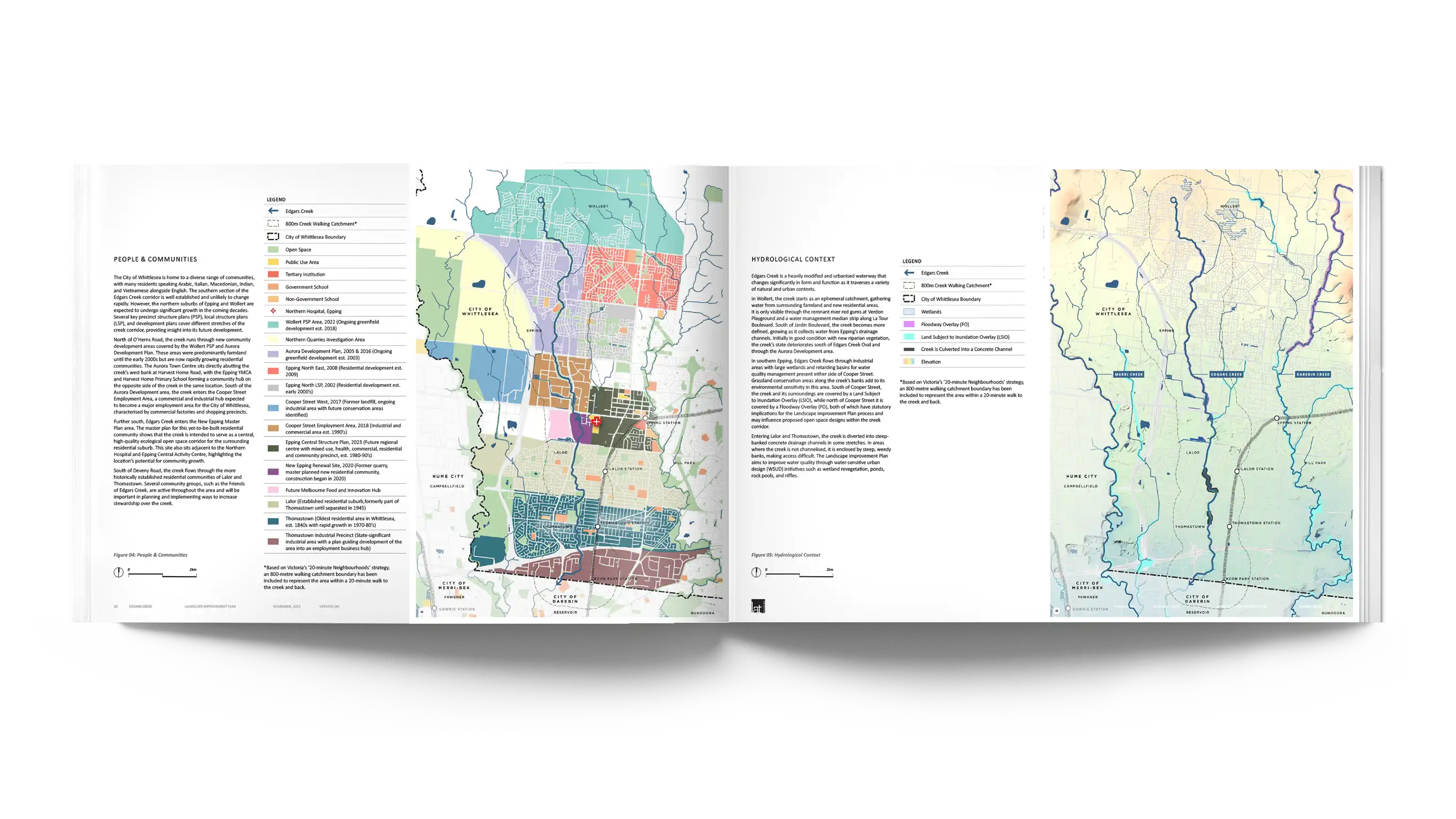
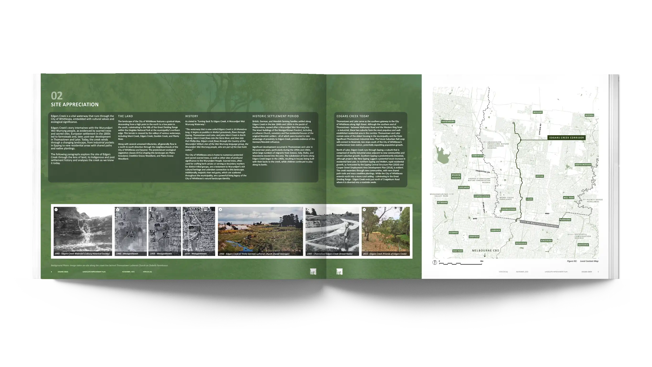
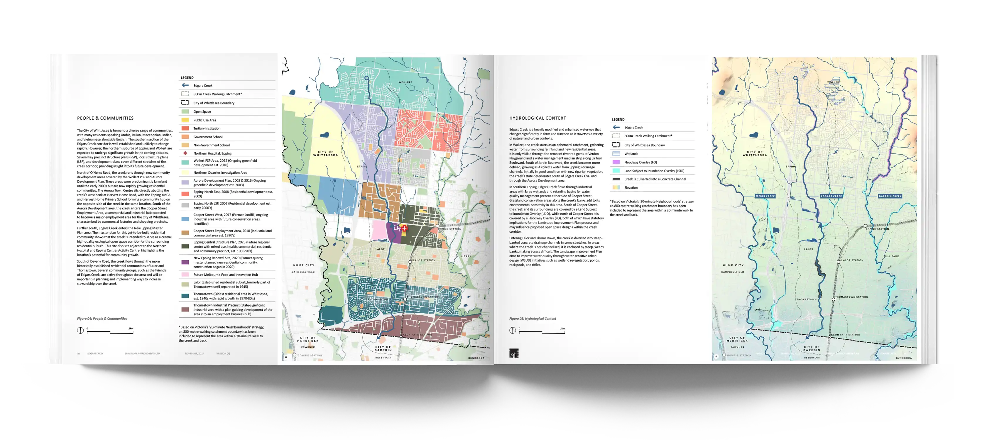
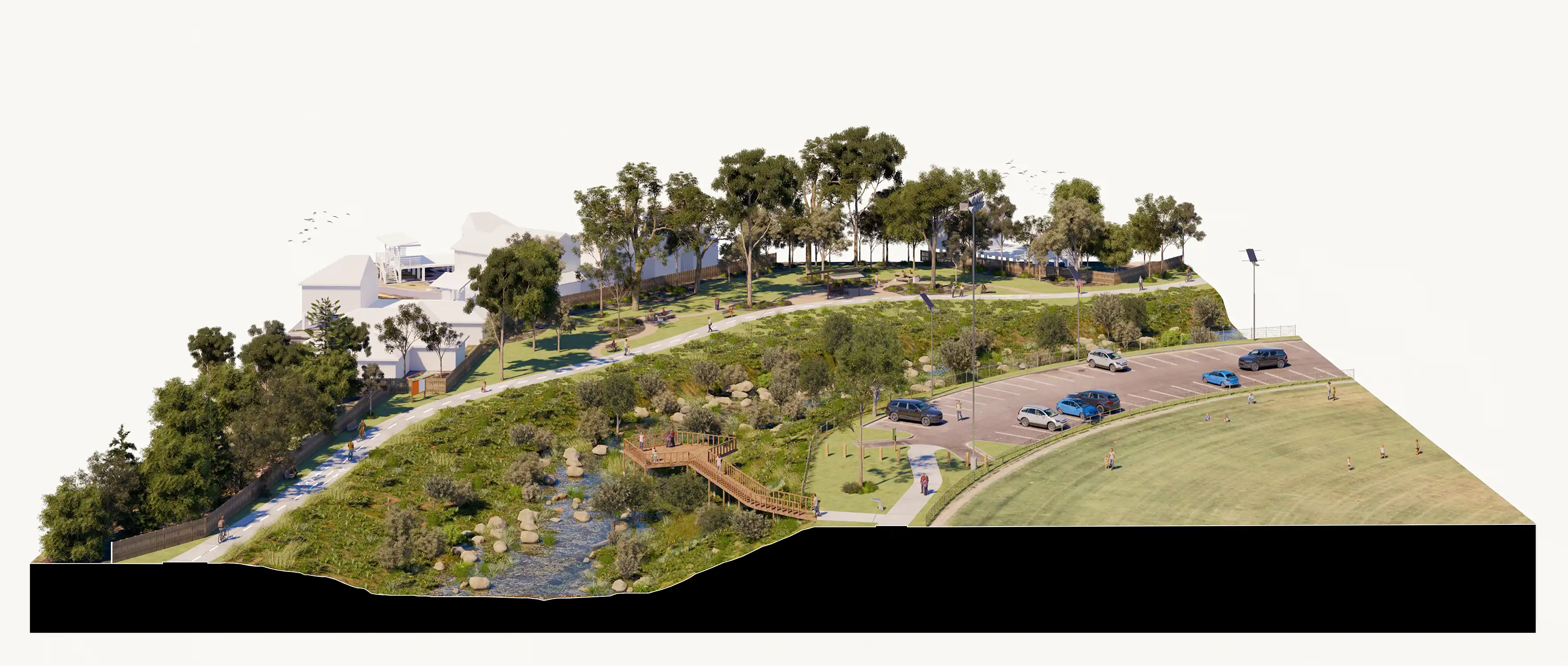
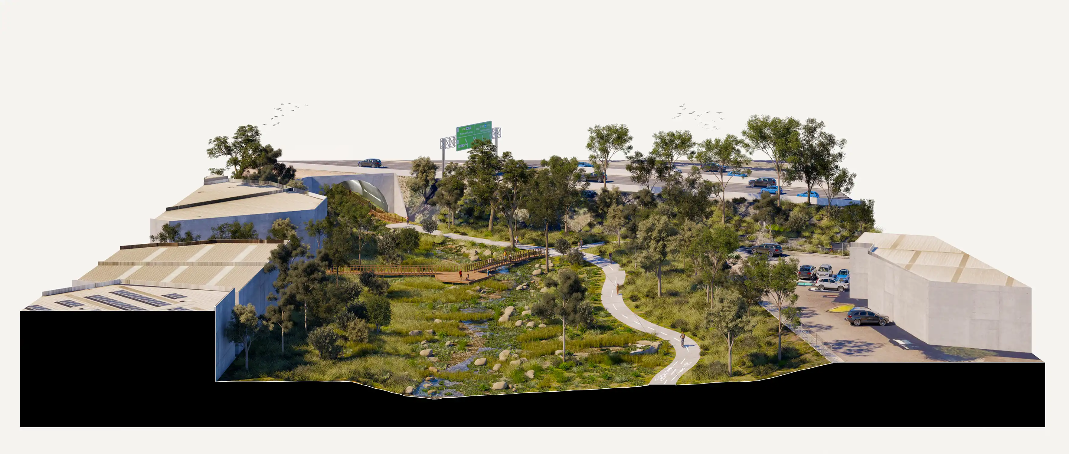
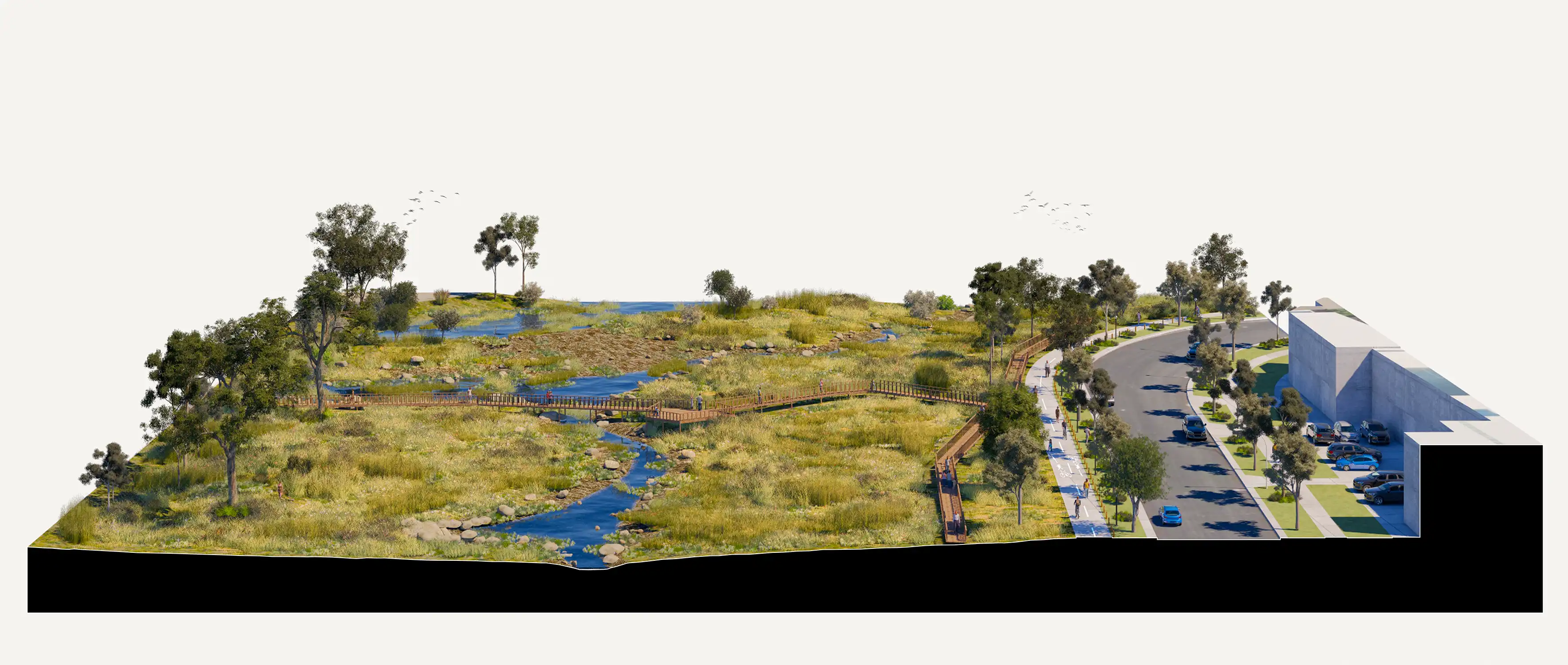
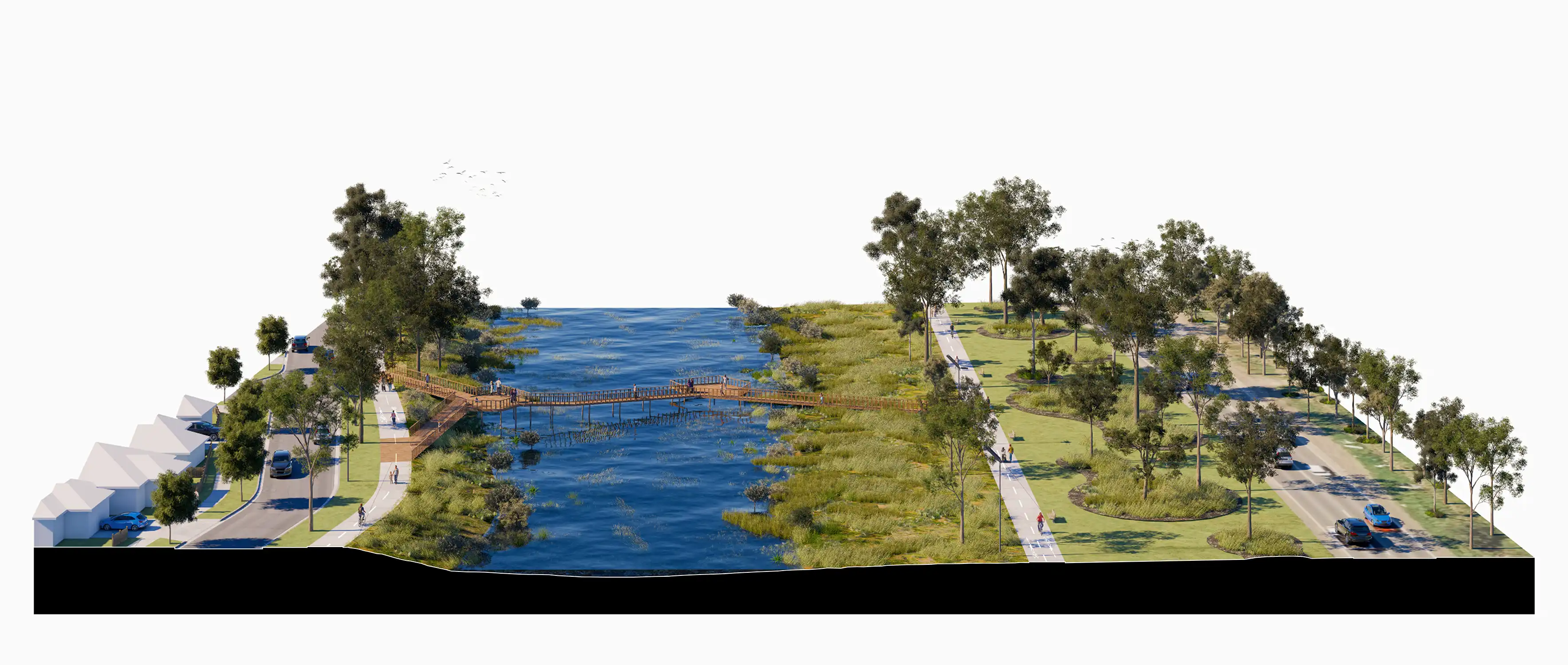
In 2025, LatStudios completed the Edgars Creek Landscape Improvement Plan for the City of Whittlesea. Edgars Creek is a vital waterway running through the centre of the municipality, steeped in cultural values and ecological significance. Although now degraded, neglected and partly channelised in sections, the Creek has the potential to form a critical recreational and environmental green spine for Whittlesea.
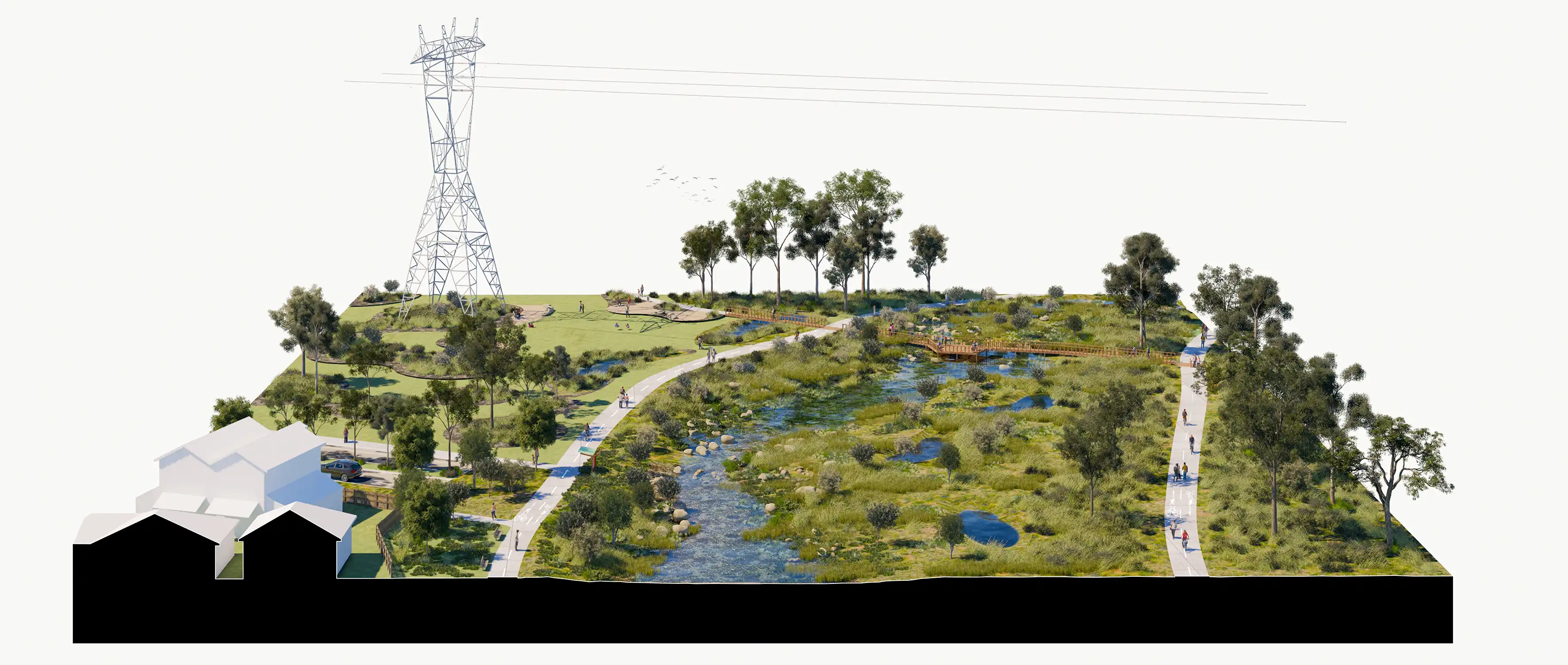
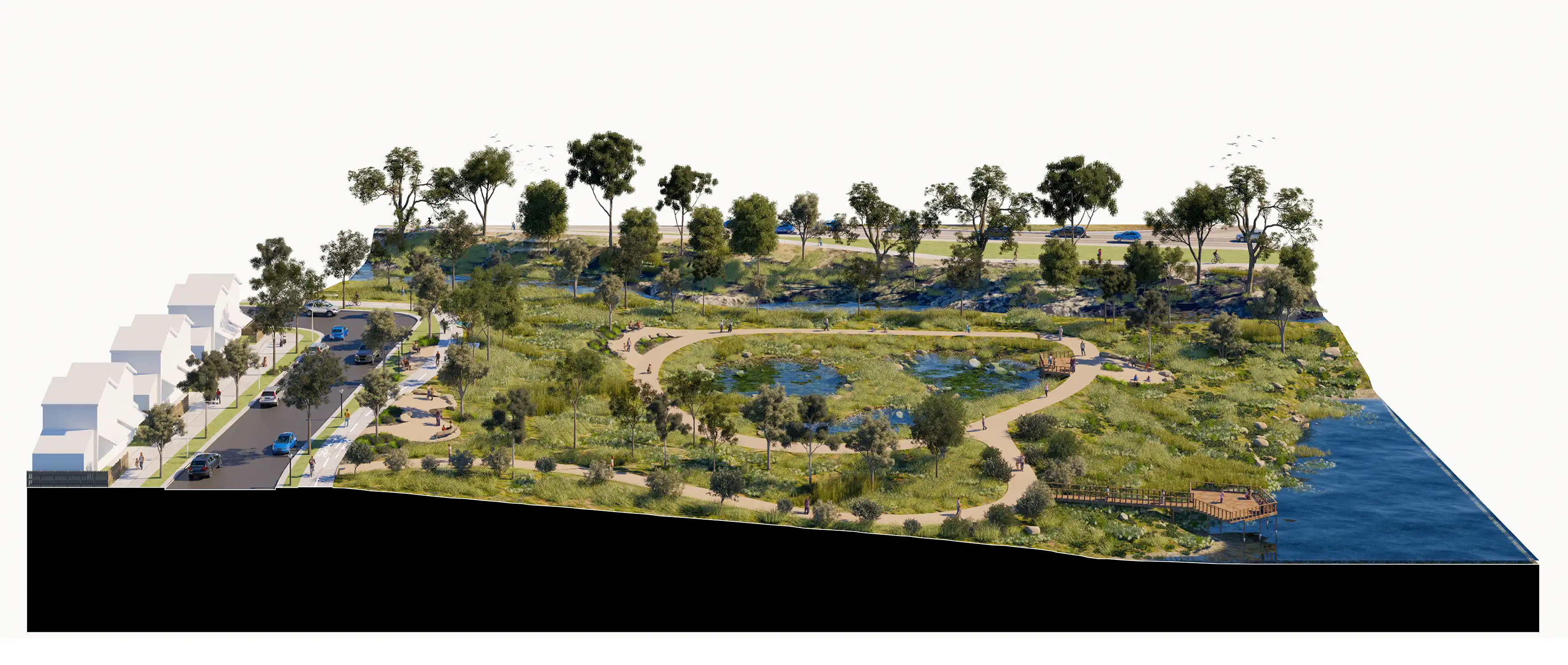
The Landscape Improvement Plan establishes a clear and integrated vision for transforming Edgars Creek into a vibrant, resilient and inclusive green spine that reflects the area’s history, culture and communities. It addresses key considerations including Traditional Owner custodianship and connection to Country, connectivity and public access, visibility and safety, interfaces with adjacent land, and the protection and enhancement of the waterway.
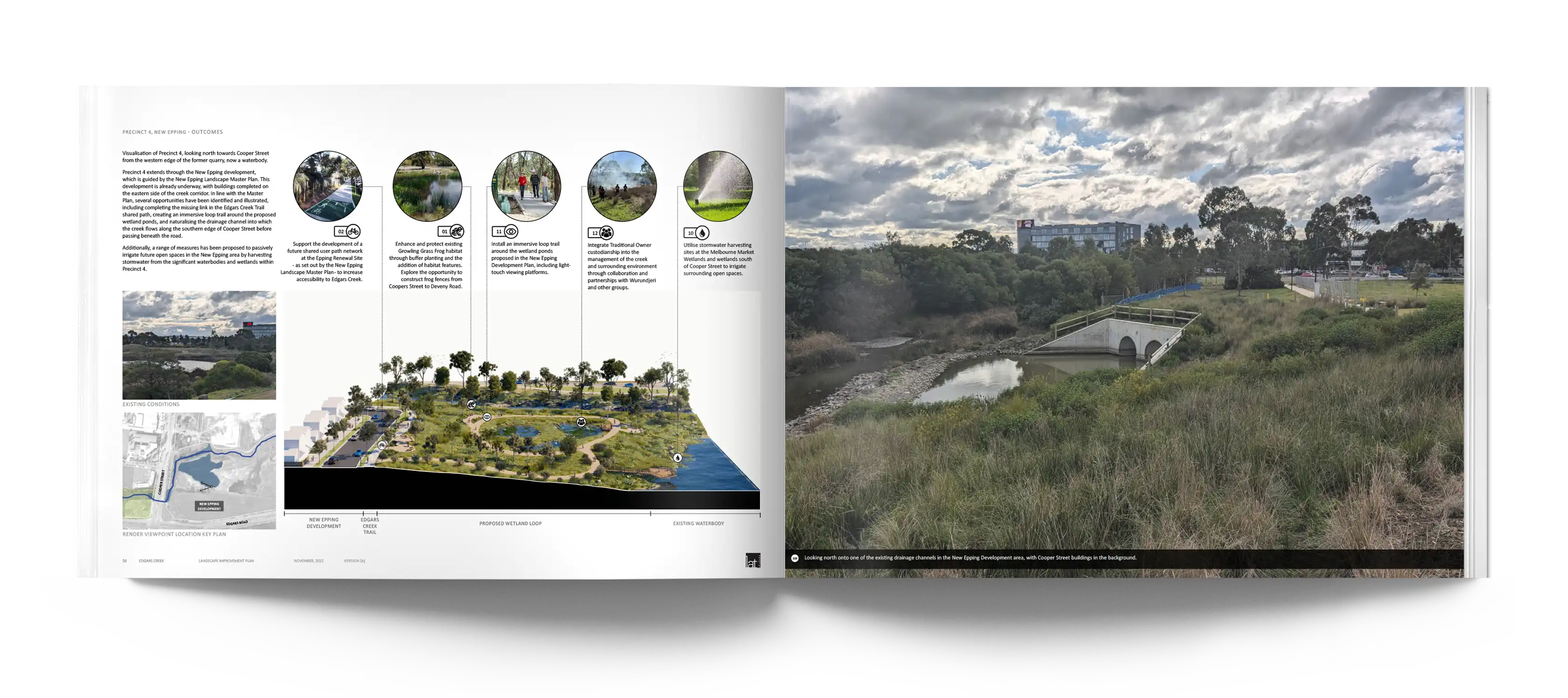
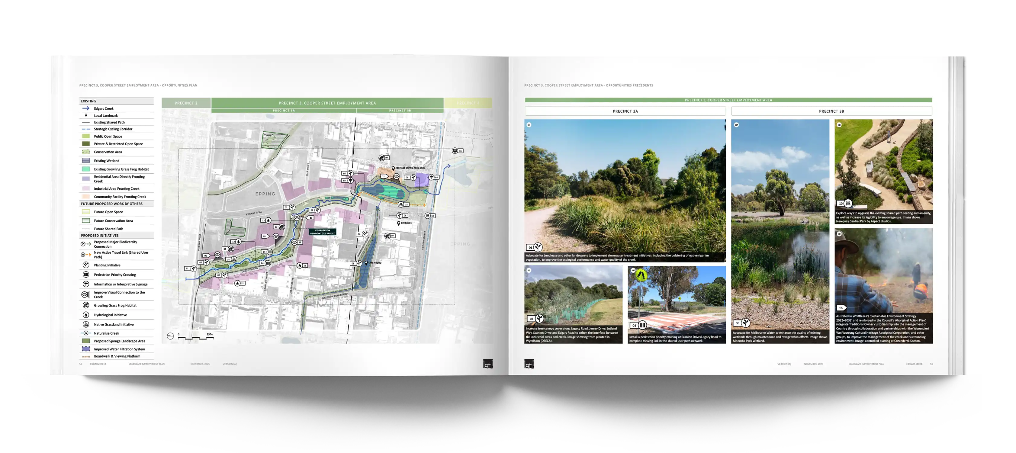
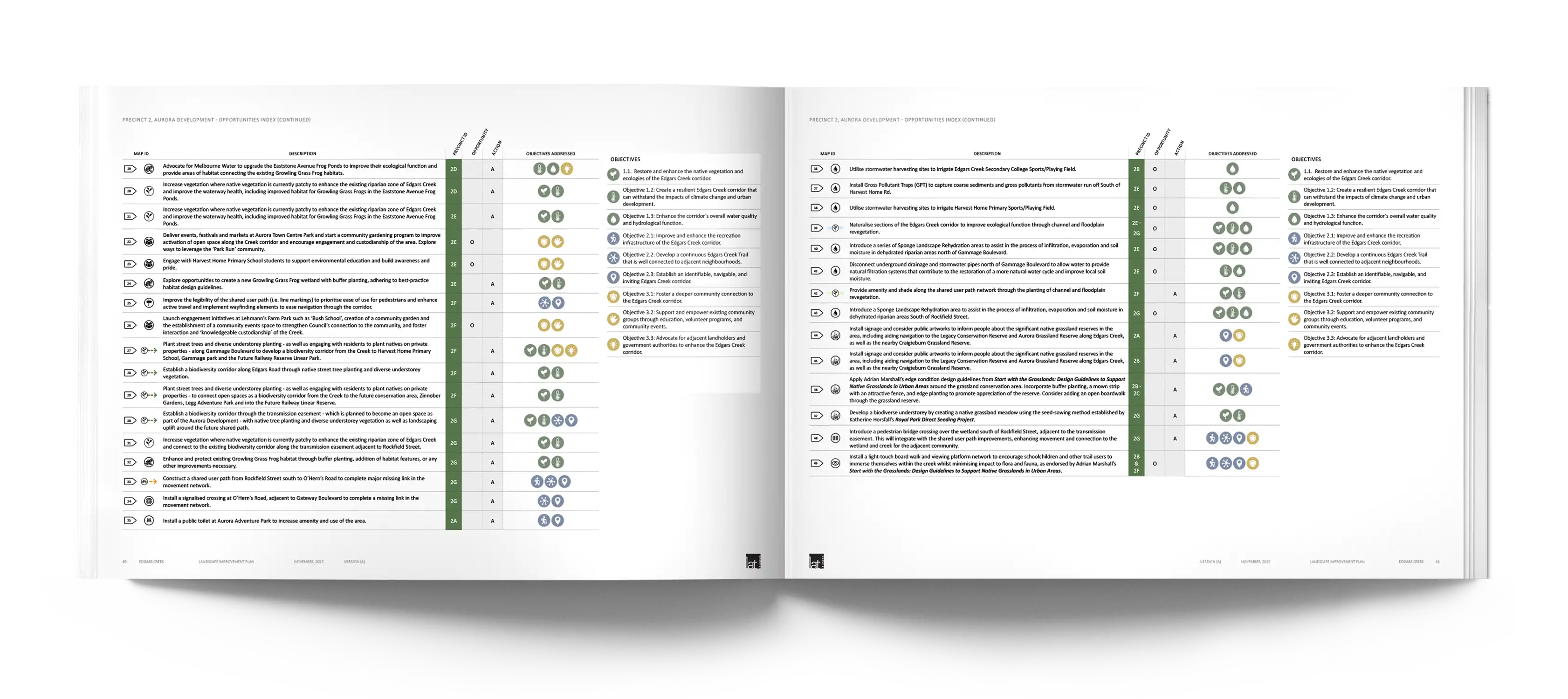
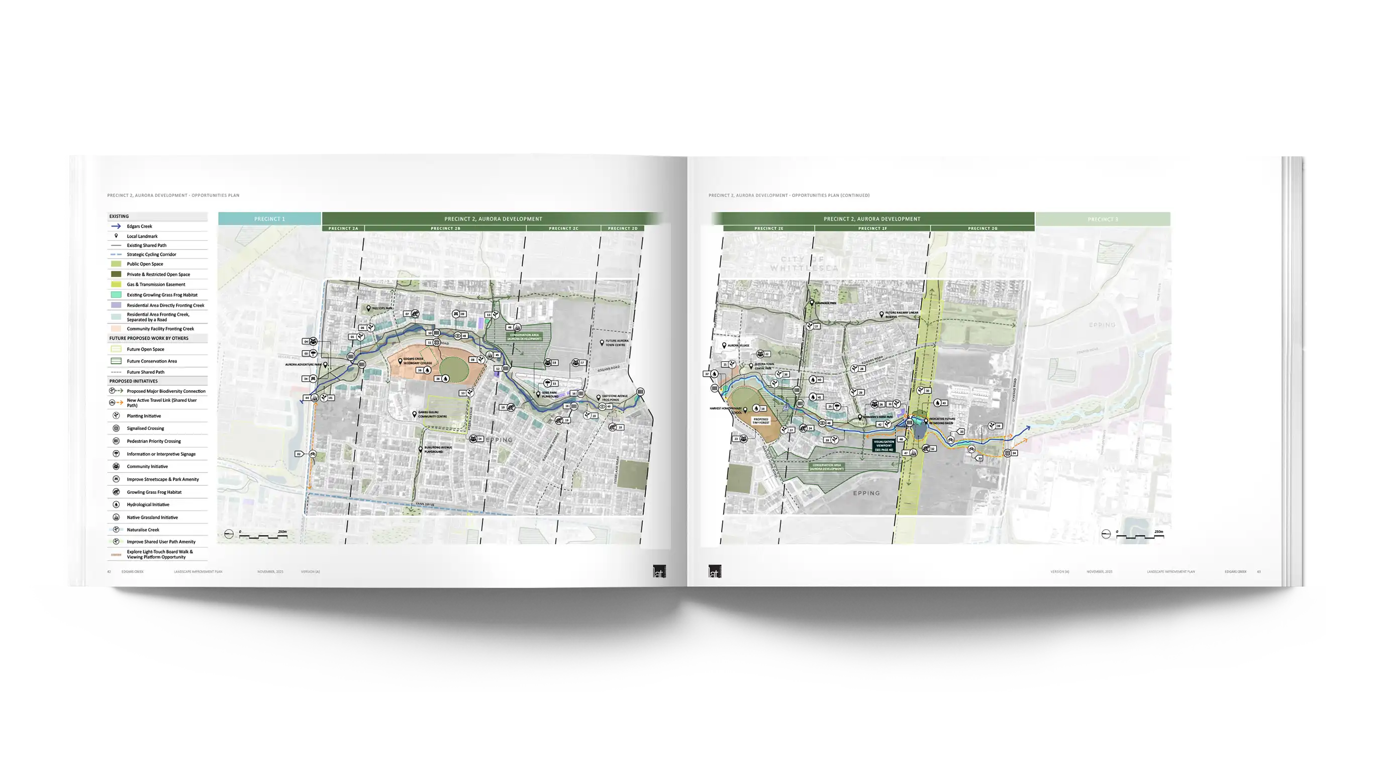
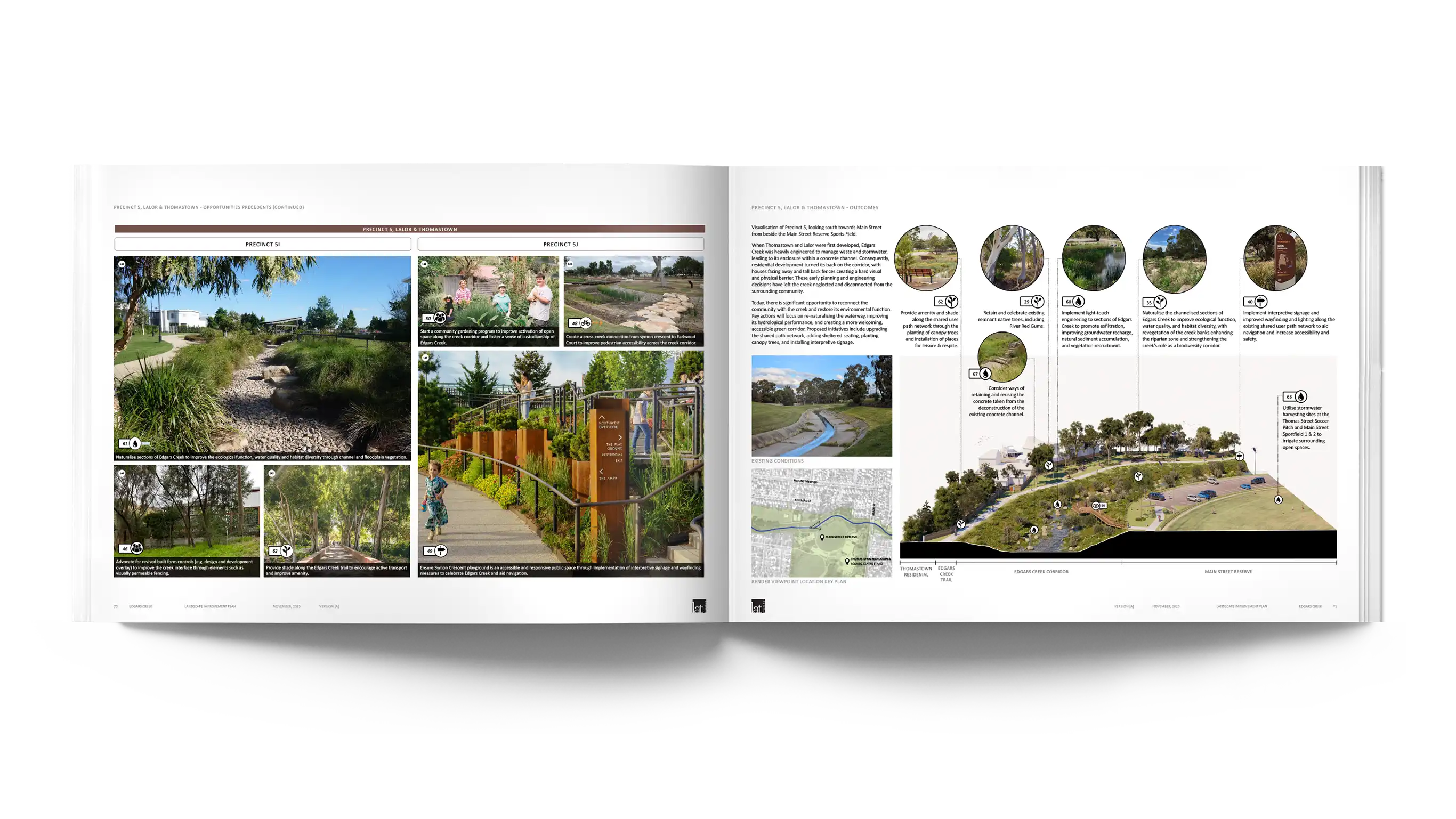
Guided by three overarching themes – Ecology and Biodiversity, Recreation and Accessibility, and Social and Community Engagement – the Plan responds to issues of connectivity and public access, visibility and safety, interfaces with adjacent housing and communities, and the protection and hydrological enhancement of the waterway. It sets out objectives and actions to strengthen habitat connections, improve open space and active travel networks, enhance amenities and wayfinding, and foster an inclusive and welcoming corridor for people of all cultures, genders, ages and abilities.
The Plan also provides a prioritised suite of initiatives to support future funding, staging and implementation, helping to secure long-term ecological health, better connectivity, improved public amenity, strong community engagement and the celebration of cultural identity across the Edgars Creek Corridor.